Glacier Park

Our Favorite Businesses
Follow Us
On Social

Firebrand Pass
Includes Lubec Trailhead, Ole Creek

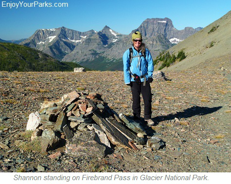
Firebrand Pass, Glacier National Park
Firebrand Pass
Trailhead: Lubec Trailhead
(Six miles south of East Glacier on Highway 2, mile marker #203)
Distance: 4.8 miles (one way)
Elevation Gain: 2,210 vertical feet
Firebrand Pass is a very enjoyable Glacier National Park hike that is not well known to most visitors due to its out-of-the-way location. But Firebrand Pass is a treasure for those Glacier Park visitors who actually discover this trail because they are greatly rewarded. The view from Firebrand Pass is tremendous and the hike is quite scenic and diverse. Firebrand Pass is yet another of the many Glacier Park hikes that deserves discussion.
How To Find The Trailhead
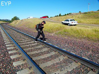 The trailhead to Firebrand Pass is located along Highway 2, about 6 miles south of East Glacier Montana. It's at mile marker 203, and is across the railroad tracks. Park your car at the obvious parking area along the railroad tracks and make sure there are no trains coming before you attempt to cross these busy tracks. The Lubec Trailhead sign marks the beginning of your hike to Firebrand Pass. This Glacier Park hike is not well known, so you will not see many other hikers (if at all) during your day on the Firebrand Pass Trail.
The Hike To Firebrand Pass
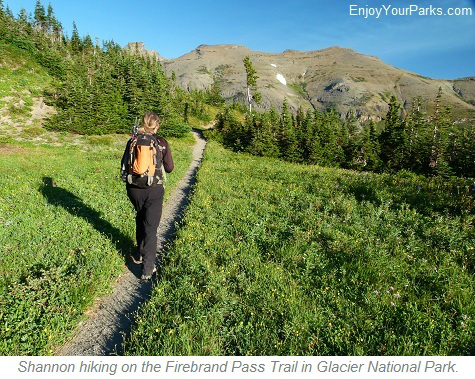
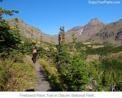
The trail to Firebrand Pass initially works it's way westward through open meadows and aspens along Coonsa Creek.
The trail then takes a turn slightly northward where you will reach a junction with Autumn Creek Trail at about mile 1.5. Make sure to turn northward (right) when you reach this junction.
The trail then follows the east slope of Calf Robe Mountain and works its way through a pleasant lodge pole forest for about a mile.
You will then enter a large grassy meadow, where the junction with the actual Firebrand Pass Trail begins. Take a left at this junction....
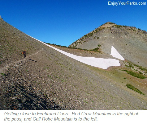
Once you're near Firebrand Pass, you might encounter a large snow field directly between you and the pass. If this snow field is present, it is safest to hike around it to its left side. There is a well worn hikers' trail found among the loose rocks and scree that you can easily follow.
When you reach Firebrand Pass, you will be greeted by an amazing view of many of the mountains that separate the deep valleys of Ole Creek and Park Creek in Glacier National Park. You look down nearly the entire length of Ole Creek directly below the pass to the south. Park Creek is directly beyond the massive wall of mountains the you will enjoy seeing to the west, which includes Eagle Ribs Mountain, Mount Despair, Peak 8888, Brave Dog Mountain, Sheep Mountain and Soldier Mountain. This is very remote country that is seldom seen by visitors. The massive mountain directly to the left (east) of Firebrand Pass is Calf Robe Mountain, and directly to the west (right) of Firebrand Pass is Red Crow Mountain. Further southward of Calf Robe Mountain is Summit Mountain, which is a very prominent mountain seen from Highway 2.
The trail does indeed keep going down into the abyss of the Ole Creek Valley, which is only for overnight backpackers who are heading for the end of the trail at the Walton Ranger Station along the lower west side of Glacier National Park along Highway 2.
Suggestion:
LEAVE EARLY! The sun is really at its best for enjoying the beauty of the westward mountains from Firebrand Pass in the morning, preferably before 10:30am. The sun then becomes quite harsh and "washes" out this spectacular view. Therefore, leave as early as you can, preferably at dawn.
Firebrand Pass is a wonderful Glacier Park hike that is always rewarding for those you find out about this little known treasure. The country that you are looking into from Firebrand Pass is extremely remote and is rarely seen by Glacier Park visitors. We personally feel it's one of our favorite day hikes in Glacier National Park in the southeast region, and we always look forward to hiking on this enjoyable Glacier Park trail.

This is a great view to the southwest from Firebrand Pass in Glacier National Park. Directly below Shannon is the Ole Creek Valley. The large mountain in the center of the photo is Mount Despair.

Share This Page On Social:
